Layers
The following is the complete set of supported layers sorted by type for Xweather Raster Maps. Use our Map Builder to quickly generate your static map and tile layers with the layer combinations you need, or refer to our layer usage documentation for more information on requesting map imagery.
Layer Modifiers
Some layers support additional modifiers, which can be used to control the type of data provided by the layer. You can include one modifier option from each modifier group supported by that layer separated by a dash, e.g. alerts-severe is a modifier on alerts.
Search
All
All available layers.
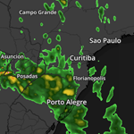
radar-global
Global radar combining actual radar with satellite derived radar where actual radar information is unavailable
Updates
2 min
Range
-30 days
Regions
Global
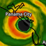
radar
Radar information for regions globally
Updates
US: 2 min, Global: 6-10 min
Range
-30 days
Regions
US, Puerto Rico, Guam, Canada, Australia, Japa, South Korea, Germany, Ireland, United Kingdom, Switzerland, Northern France, Belgium, Netherlands, US, Canada, Guam, Puerto Rico, Australia, Germany, Japan, Uk, South Korea, Netherlands, Belgium, Northern France, Switzerland, Ireland
Modifiers
Region
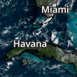
satellite-geocolor
Geocolor Global Satellite
Updates
US/Japan/AUS: 10 min, EU: 15 min
Range
-7 days
Regions
Global
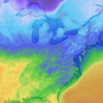
temperatures
Surface temperatures.
Updates
1hr
Range
-7 days
Regions
Global
Modifiers
Source
rtma
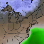
dew-points
Dew point temperature.
Updates
1hr
Range
-7 days
Regions
Global
Modifiers
Source
rtma

feels-like
Feels-like, or apparent, temperature.
Updates
1hr
Range
-7 days
Regions
Global
Modifiers
Source
rtma
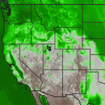
humidity
Relative humidity percentage.
Updates
1hr
Range
-7 days
Regions
Global
Modifiers
Source
rtma
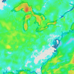
wind-speeds
Surface wind speeds.
Updates
1hr
Range
-7 days
Regions
Global
Modifiers
Source
rtma

wind-gusts
Surface wind gusts.
Updates
1hr
Range
-7 days
Regions
Global
Modifiers
Source
rtma
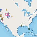
alerts
All currently active US, Canadian and European alerts as issued by the National Weather Service (NWS), Environment Canada (EC), MeteoAlarm, Australian Bureau of Meteorology (AUSBOM), and the UK Met Office.
Updates
2-3 minutes
Range
-30 days
Regions
US, Canada, Europe, Australia
Modifiers
Category
severe, fire, flood , frost-freeze, heat, wind, winter, surge
Advisory Type
watches, warnings
Style
outlines
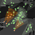
stormcells
Radar-derived data that attempts to identify and track storm cell movement, along with reporting cell intensity and certain severe weather signatures within the cell, like rotation and hail. This layer is a combination of `stormcells-positions`, `stormcells-tracks`, and `stormcells-cones`.
Updates
3 minutes
Range
-7 days
Regions
US
Modifiers
Category
general, hail, major, rotating, tornado
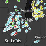
stormreports
24 hours of storm reports throughout the US.
Updates
15 minutes
Range
-7 days
Regions
US
Modifiers
Category
avalanche, blizzard, fire, flood, fog, hail, ice, lightning, rain, snow, tides, tornado, wind
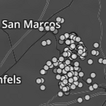
lightning-flash
Aggregated cloud-to-ground and intracloud lightning flashes in the last 5 minutes.
Updates
5 minutes
Range
-7 days
Regions
Global
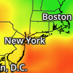
air-quality-index
Air Quality Index.
Updates
12 hours
Range
-7 days to +4.5 days
Regions
Global
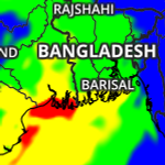
air-quality-health-index-categories
Vaisala Xweather Air Quality Health Index, presenting how air quality affects an individual's health.
5x Multiplier
Updates
12 hours
Range
-7 days to +4.5 days
Regions
Global
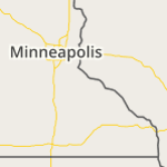
admin
Administration boundaries and labels, including country, states major cities
Updates
Range
Regions
Global
Modifiers
Font Size
lg
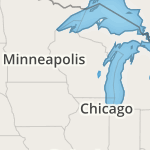
admin-cities
Standard admin layers with emphasis on city names versus state / country names.
Updates
Range
Regions
Global
Modifiers
Font Size
lg
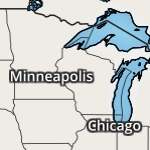
admin-cities-dk
Standard admin layers with emphasis on city names versus state / country names.
Updates
Range
Regions
Global
Modifiers
Font Size
lg
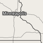
admin-dk
Administration boundaries and labels, including country, states major cities
Updates
Range
Regions
Global
Modifiers
Font Size
lg
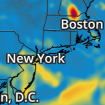
air-quality-co
Carbon Monoxide concentration.
5x Multiplier
Updates
12 hours
Range
-7 days to +4.5 days
Regions
Global
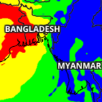
air-quality-index-cai-categories
Korean Comprehensive Air-quality Index (CAI) categories and calculations
5x Multiplier
Updates
12 hours
Range
-7 days to +4.5 days
Regions
Global
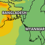
air-quality-index-caqi-categories
Common Air Quality Index categories and calculations
5x Multiplier
Updates
12 hours
Range
-7 days to +4.5 days
Regions
Global
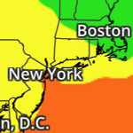
air-quality-index-categories
Air Quality Index Categories.
Updates
12 hours
Range
-7 days to +4.5 days
Regions
Global
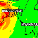
air-quality-index-china-categories
Chinese Government AQI categories
5x Multiplier
Updates
12 hours
Range
-7 days to +4.5 days
Regions
Global
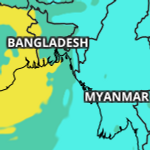
air-quality-index-eaqi-categories
European Air Quality Index categories and calculations
5x Multiplier
Updates
12 hours
Range
-7 days to +4.5 days
Regions
Global
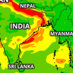
air-quality-index-india-categories
India AQI categories
5x Multiplier
Updates
12 hours
Range
-7 days to +4.5 days
Regions
Global
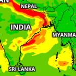
air-quality-index-uba-daqi-categories
German Air Quality categories and calculations
5x Multiplier
Updates
12 hours
Range
-7 days to +4.5 days
Regions
Global
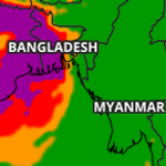
air-quality-index-uk-daqi-categories
UK AQI categories and calculations
5x Multiplier
Updates
12 hours
Range
-7 days to +4.5 days
Regions
Global
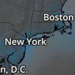
air-quality-no
Nitrogen Monoxide concentration.
5x Multiplier
Updates
12 hours
Range
-7 days to +4.5 days
Regions
Global
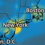
air-quality-no2
Nitrogen Dioxide concentration.
5x Multiplier
Updates
12 hours
Range
-7 days to +4.5 days
Regions
Global
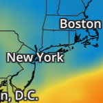
air-quality-o3
Ozone concentration.
5x Multiplier
Updates
12 hours
Range
-7 days to +4.5 days
Regions
Global
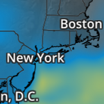
air-quality-pm10
Particulate Matter < 10um concentration.
5x Multiplier
Updates
12 hours
Range
-7 days to +4.5 days
Regions
Global
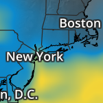
air-quality-pm2p5
Particulate Matter < 2.5um concentration.
5x Multiplier
Updates
12 hours
Range
-7 days to +4.5 days
Regions
Global
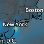
air-quality-so2
Sulfer Dioxide concentration.
5x Multiplier
Updates
12 hours
Range
-7 days to +4.5 days
Regions
Global
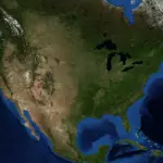
blue-marble
Blue marble base layer.
Updates
Range
Regions
Global
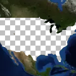
clip-us-blue-marble
Blue Marble base layer with transparent US
Updates
Range
Regions
US
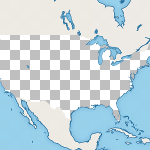
clip-us-flat
Flat base layer with transparent US.
Updates
Range
Regions
US
Modifiers
Map Theme
dk
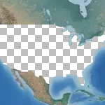
clip-us-terrain
Terrain base layer with transparent US
Updates
Range
Regions
US
Modifiers
Map Theme
dk
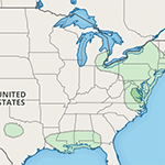
convective
SPC Convective Outlook throughout the US.
Updates
As needed
Range
Regions
Continental US
Modifiers
Category
hail, torn, wind
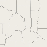
counties
County / Parish outlines within the US.
Updates
Range
Regions
US
Modifiers
Map Theme
dk
Font Size
lg
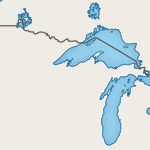
countries-outlines
Country outlines across the globe.
Updates
Range
Regions
Global
Modifiers
Map Theme
dk
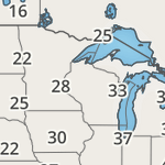
dew-points-text
Numeric values of dew point temperature.
Updates
30 minutes
Range
-7 days
Regions
Global
Modifiers
Units
metric
Map Theme
dk
Font Size
lg
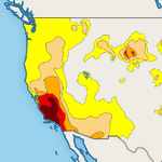
drought-monitor
Latest drought summary and severity as issued by the National Drought Mitigation Center.
Updates
Weekly
Range
Regions
US

fdew-points
Forecast dew point temperature.
Updates
HRRR: 1hr, NAM/GFS: 6 hrs
Range
+15 days
Regions
Global
Modifiers
Model
hrrr, nam, gfs, ndfd
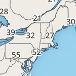
feels-like-text
Numeric values of feels-like temperature.
Updates
30 minutes
Range
-7 days
Regions
Continental US
Modifiers
Units
metric
Map Theme
dk
Font Size
lg
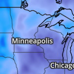
ffeels-like
Forecast feels-like temperature.
Updates
HRRR: 1hr, NAM/GFS: 6 hrs
Range
+15 days
Regions
Global
Modifiers
Model
hrrr, nam, gfs, ndfd
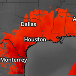
fheat-index
Forecast heat index temperature.
Updates
HRRR: 1hr, NAM/GFS: 6 hrs
Range
+15 days
Regions
Global
Modifiers
Model
hrrr, nam, gfs, ndfd

fhumidity
Forecast relative humidity percentage.
Updates
HRRR: 1hr, NAM/GFS: 6hrs
Range
+15 days
Regions
Global
Modifiers
Model
hrrr, nam, gfs, ndfd
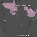
fice-accum
Forecast ice accumulation.
Updates
6 hours
Range
+15 days
Regions
US
Modifiers
Model
ndfd
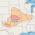
fires-dryltg-outlook
Fire Weather Outlook for dry lightning
Updates
Daily
Range
Regions
Continental US
fires-obs-icons
Current fires observed depicted via icon.
Updates
Daily
Range
-7 days
Regions
US, Canada

fires-obs-points
Current fires observed.
Updates
Daily
Range
-7 days
Regions
US, Canada

fires-outlook
Fire weather outlooks and fire conditions as issued by the Storm Prediction Center (SPC).
Updates
Daily
Range
Regions
Continental US
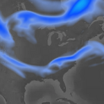
fjet-stream
Forecast jet stream at 250 mb.
Updates
Range
+15 days
Regions
Global
Modifiers
Model
hrrr, nam, gfs
flat
Flat base layer.
Updates
Range
Regions
Global
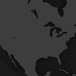
flat-dk
Dark version of flat base layer.
Updates
Range
Regions
Global
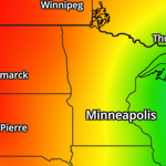
fpressure-msl
Forecast mean sea level pressure.
Updates
HRRR: 1hr, NAM/GFS: 6 hrs
Range
+15 days
Regions
Global
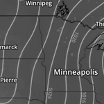
fpressure-msl-isobars
Forecast mean sea level pressure depicted with isobars.
Updates
HRRR: 1hr, NAM/GFS: 6 hrs
Range
+15 days
Regions
Global
Modifiers
Model
hrrr, nam, gfs
Map Theme
dk
Font Size
lg
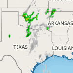
fqpf-1h
Forecast accumulated precipitation amounts in hourly intervals.
Updates
HRRR: 1hr, NAM/GFS: 6 hrs
Range
+15 days
Regions
Global
Modifiers
Model
hrrr, nam, gfs
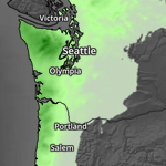
fqpf-6h
Forecast accumulated precipitation amounts in 6 hour intervals.
Updates
6 hours
Range
+15 days
Regions
US
Modifiers
Model
ndfd
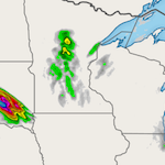
fqpf-accum
Forecast accumulated precipitation amounts in a given interval.
Updates
HRRR: 1hr, NAM/GFS: 6 hrs
Range
+15 days
Regions
Global
Modifiers
Model
hrrr, nam, gfs, ndfd
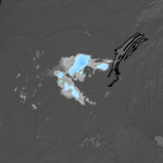
fqsf-1h
Forecast snow accumulations over a 1 hour interval.
Updates
6 hours
Range
+15 days
Regions
Global
Modifiers
Ratio
kuchera, 10to1
Model
hrrr, nam, gfs
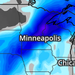
fqsf-accum
.
Updates
6 hours
Range
+15 days
Regions
Global
Modifiers
Ratio
kuchera, 10to1
Model
hrrr, nam, gfs
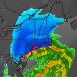
fradar
Forecast Radar based on models, either the GFS, NAM, or HRRR
Updates
HRRR: 1 hr, NAM/GFS: 6 hrs
Range
HRRR (+18 hours), NAM(+72 hours), GFS (+15 days)
Regions
Global
Modifiers
Model
hrrr, nam, gfs

fsatellite
Forecast satellite based on models, either the GFS, NAM, or HRRR
Updates
6 hours
Range
+15 days
Regions
Global
Modifiers
Model
hrrr, nam, gfs
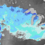
fsnow-depth
Forecast snow depth.
Updates
6 hours
Range
+15 days
Regions
Global
Modifiers
Model
hrrr, nam, gfs
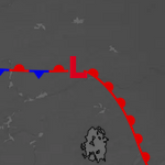
fsurface-analysis
.
Updates
12 hours
Range
Regions
North America
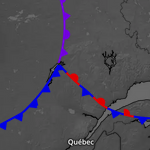
fsurface-analysis-fronts
.
Updates
12 hours
Range
Regions
North America
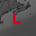
fsurface-analysis-pressure
.
Updates
12 hours
Range
Regions
North America
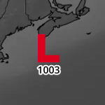
fsurface-analysis-pressure-text
.
Updates
12 hours
Range
Regions
North America
Modifiers
Map Theme
dk
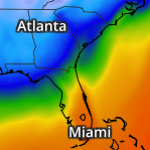
ftemperatures
Forecast surface temperatures.
Updates
HRRR: 1 hr, NAM/GFS: 6 hrs
Range
+15 days
Regions
Global
Modifiers
Model
hrrr, nam, gfs, ndfd
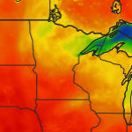
ftemperatures-max
Forecast high temperatures.
Updates
Daily
Range
+15 days
Regions
US, Puerto Rico, Guam
Modifiers
Model
ndfd
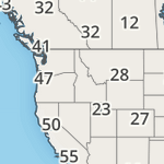
ftemperatures-max-text
Numeric value showing forecast high temperatures.
Updates
Daily
Range
+15 days
Regions
Global
Modifiers
Units
metric
Map Theme
dk
Font Size
lg
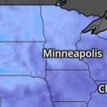
ftemperatures-min
Forecast low temperatures.
Updates
Daily
Range
+15 days
Regions
US, Guam, Puerto Rico
Modifiers
Model
ndfd

ftemperatures-min-text
Numeric value of forecast low temperature.
Updates
Daily
Range
+15 days
Regions
Global
Modifiers
Units
metric
Map Theme
dk
Font Size
lg
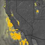
fvisibility
Forecast visibility as a distance.
Updates
HRRR: 1hr, NAM: 6hrs
Range
+15 days
Regions
Continental US
Modifiers
Model
hrrr, nam
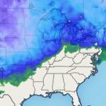
fwind-chill
Forecast wind chill temperatures.
Updates
HRRR: 1hr, NAM/GFS: 6 hrs
Range
+15 days
Regions
Global
Modifiers
Model
hrrr, nam, gfs
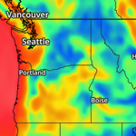
fwind-gusts
Forecast surface wind gusts.
Updates
HRRR: 1hr, NAM/GFS: 6 hrs
Range
+15 days
Regions
Global
Modifiers
Model
hrrr, nam, gfs, ndfd
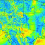
fwind-speeds
Forecast surface wind speeds.
Updates
HRRR: 1hr, NAM/GFS: 6 hrs
Range
+15 days
Regions
Global
Modifiers
Model
hrrr, nam, gfs, ndfd

heat-index
Heat index, where temperatures are at or above 80F (26.67C).
Updates
1hr
Range
-7 days
Regions
Global
Modifiers
Source
rtma
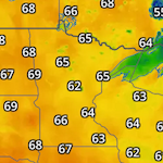
heat-index-text
Numeric values of heat index temperature.
Updates
30 minutes
Range
-7 days
Regions
Global
Modifiers
Units
metric
Map Theme
dk
Font Size
lg
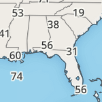
humidity-text
Numeric value of relative humidity percentage.
Updates
30 minutes
Range
-7 days
Regions
Global
Modifiers
Map Theme
dk
Font Size
lg
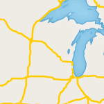
interstates
Major interstates / highways around the globe.
Updates
Range
Regions
Global
Modifiers
Map Theme
dk
Font Size
lg
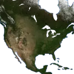
land-blue-marble
Land mask using blue marble base layer.
Updates
Range
Regions
Global

land-flat
Flat base layer with transparent US.
Updates
Range
Regions
Global
Modifiers
Map Theme
dk
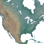
land-terrain
Terrain land mask.
Updates
Range
Regions
Global
Modifiers
Map Theme
dk

land-us-flat
Flat base layer with transparent US only.
Updates
Range
Regions
US
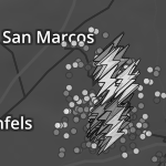
lightning-all
Aggregated cloud-to-ground and intracloud lightning flashes in the last 5 or 15 (default) minutes.
10x Multiplier
Updates
5 minutes
Range
-7 days
Regions
Global
Modifiers
Icon Size
lg
lightning-all-15m
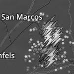
Aggregated cloud-to-ground and intracloud lightning flashes in the last 15 minutes.
10x Multiplier
Updates
15 minutes
Range
-7 days
Regions
Global
Modifiers
Icon Size
lg
lightning-all-5m
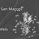
Aggregated cloud-to-ground and intracloud lightning flashes in the last 5 minutes.
10x Multiplier
Updates
5 minutes
Range
-7 days
Regions
Global
Modifiers
Icon Size
lg
lightning-flash-5m-icons
Aggregated cloud-to-ground and intracloud lightning flashes in the last 5 minutes.
Updates
5 minutes
Range
-7 days
Regions
Global
Modifiers
Icon Size
lg
lightning-strike-density
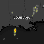
A heat map of the number of lightning strikes within an 8km resolution, as provided by NOAA
Updates
15 minutes
Range
-7 days
Regions
Central America, East Pacific, US
lightning-strikes
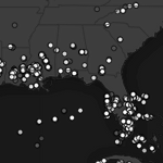
Cloud-to-ground lightning strikes in the last 5 or 15 (default) minutes.
10x Multiplier
Updates
5 minutes
Range
-7 days
Regions
Global
Modifiers
Timeframe
15m, 5m
lightning-strikes-15m-icons
Cloud-to-ground lightning strikes in the last 15 minutes.
10x Multiplier
Updates
15 minutes
Range
-7 days
Regions
Global
Modifiers
Icon Size
lg
lightning-strikes-5m-icons
Cloud-to-ground lightning strikes in the last 5 minutes.
10x Multiplier
Updates
5 minutes
Range
-7 days
Regions
Global
Modifiers
Icon Size
lg
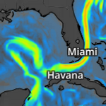
maritime-currents
Ocean Currents
Updates
6 hours
Range
-7 days
Regions
Global
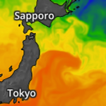
maritime-sst
Sea Surface Temperatures
Updates
6 hours
Range
-7 days
Regions
Global
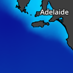
maritime-surges
Amount of abnormal rise of water over and above the predicted astronomical tides due to storm activity. (Not inland storm surge)
Updates
6 hours
Range
-7 days
Regions
Global
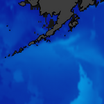
maritime-swell-2-heights
Secondary Swell Heights
Updates
8 hours
Range
-7 days
Regions
Global
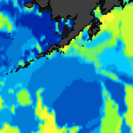
maritime-swell-2-periods
Secondary Swell Periods
Updates
6 hours
Range
-7 days
Regions
Global
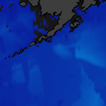
maritime-swell-3-heights
Tertiary Swell Heights
Updates
6 hours
Range
-7 days
Regions
Global
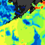
maritime-swell-3-periods
Tertiary Swell Periods
Updates
6 hours
Range
-7 days
Regions
Global
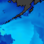
maritime-swell-heights
Primary Swell Heights
Updates
6 hours
Range
-7 days
Regions
Global
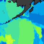
maritime-swell-periods
Primary Swell Periods
Updates
6 hours
Range
-7 days
Regions
Global
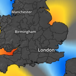
maritime-tides
Tide Height
Updates
6 hours
Range
-7 days
Regions
Global

maritime-wave-heights
Primary Wave Heights
Updates
6 hours
Range
-7 days
Regions
Global
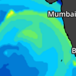
maritime-wave-periods
Primary Wave Periods
Updates
6 hours
Range
-7 days
Regions
Global
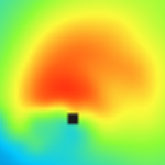
maritime-wind-wave-heights
Primary Wind Wave Heights
Updates
6 hours
Range
-7 days
Regions
Global
maritime-wind-wave-periods
Primary Wind Wave Periods
Updates
6 hours
Range
-7 days
Regions
Global
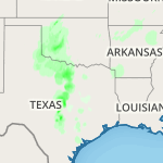
precip
Accumulated precipitation amounts per interval.
Updates
Hourly, Daily (AHPS)
Range
-7 days
Regions
Continental US, Alaska, Puerto Rico
Modifiers
Time Range
1h, 1d, 7d, 14d, 30d, 60d, 90d, 180d, mtd, ytd, wytd
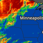
precip-depart
Departure from precipitation normals.
Updates
Daily
Range
-7 days
Regions
Continental US, Alaska, Puerto Rico
Modifiers
Time Range
1d, 7d, 14d, 30d, 60d, 90d, 180d, mtd, ytd, wytd
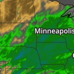
precip-depart-percent
Departure from precipitation normals as a percentage.
Updates
Daily
Range
7 days
Regions
Continental US, Puerto Rico, Alaska
Modifiers
Time Range
1d, 7d, 14d, 30d, 60d, 90d, 180d, mtd, ytd, wytd
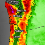
precip-normals
Precipitation normals for a given time range.
Updates
Daily
Range
-7 days
Regions
Continental US, Alaska, Puerto Rico
Modifiers
Time Range
1d, 7d, 14d, 30d, 60d, 90d, 180d, mtd, ytd, wytd
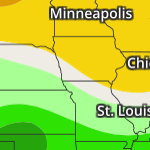
precip-outlook-6-10d-cpc
The CPC 6 to 10 day Precipitation outlook
Updates
Daily
Range
Regions
US
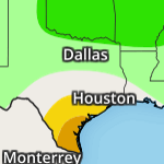
precip-outlook-8-14d-cpc
The CPC 8 to 14 day Precipitation outlook
Updates
Daily
Range
Regions
US
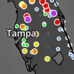
river-observations
River and Lake Gauge observations from the NOAA Advanced Hydrologic Prediction Service (AHPS)
Updates
Hourly
Range
-7 days
Regions
US
Modifiers
Category
flooding, low-threshold
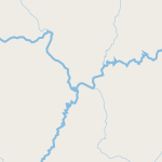
rivers
Rivers across the globe.
Updates
Range
Regions
Global
Modifiers
Map Theme
dk
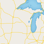
roads
Major roads across the U.S.
Updates
Range
Regions
US
Modifiers
Map Theme
dk
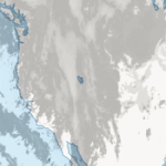
satellite
Black and white infrared satellite imagery.
Updates
US: 15 min, Global: 3hrs
Range
-7 days
Regions
Global
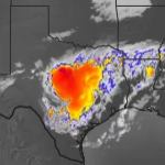
satellite-infrared-color
Color infrared satellite imagery based on cloud top temperature.
Updates
Global: 2 hrs, US: 15 min
Range
-7 days
Regions
Global
Modifiers
Region
US
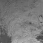
satellite-visible
Visible satellite imagery.
Updates
15 minutes
Range
-7 days
Regions
North America, Central America, East Pacific, West Atlantic
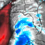
satellite-water-vapor
Satellite imagery depicting the amount of water vapor in the atmosphere.
Updates
15 minutes
Range
-7 days
Regions
North America, Central America, East Pacific, West Atlantic

snow-depth
.
Updates
day
Range
-7 days
Regions
Global, North America
Modifiers
Coverage
global
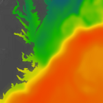
sst
Sea surface temperatures across the globe.
Updates
Daily
Range
-7 days
Regions
Global
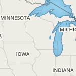
states
State / Province outlines and labels
Updates
Range
Regions
Global
Modifiers
State Outlines
outlines
Map Theme
dk
Font Size
lg

surface-analysis
Frontal and pressure analysis.
Updates
12 hours
Range
-7 days
Regions
North America

surface-analysis-fronts
Surface analysis of fronts only.
Updates
12 hours
Range
-7 days
Regions
North America

surface-analysis-pressure
Surface analysis of pressure only.
Updates
12 hours
Range
-7 days
Regions
North America

surface-analysis-pressure-text
Surface analysis of pressure with numeric pressure values.
Updates
12 hours
Range
-7 days
Regions
North America
Modifiers
Map Theme
dk
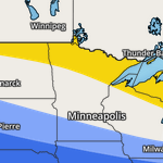
temperatures-outlook-6-10d-cpc
The CPC 6 to 10 day Temperature outlook
Updates
Daily
Range
Regions
US
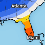
temperatures-outlook-8-14d-cpc
The CPC 8 to 14 day Temperature outlook
Updates
Daily
Range
Regions
US

temperatures-text
Numeric values of surface temperatures.
Updates
30 minutes
Range
-7 days
Regions
Global
Modifiers
Unites
metric
Map Theme
dk
Font Size
lg
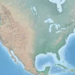
terrain
Terrain base layer.
Updates
Range
Regions
Global

terrain-dk
Dark terrain base layer.
Updates
Range
Regions
Global
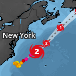
tropical-cyclones
Active tropical cyclones with up to a 5 day forecast.
Updates
1-6 hours
Range
-7 days
Regions
Global
tropical-cyclones-break-points
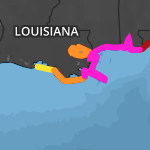
Coastal areas under cyclone watches or warnings.
Updates
1-6 hours
Range
-7 days
Regions
East Pacific, West Atlantic

tropical-cyclones-forecast-error-cones
Probable track of the center of a tropical cyclone
Updates
1-6 hours
Range
-7 days
Regions
Global
tropical-cyclones-forecast-lines
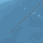
Probable track of the center of a tropical cyclone, displayed as lines.
Updates
1-6 hours
Range
-7 days
Regions
Global
tropical-cyclones-forecast-point-icons
Probable track of the center of a tropical cyclone, displayed as icons.
Updates
1-6 hours
Range
-7 days
Regions
Global
tropical-cyclones-forecast-points
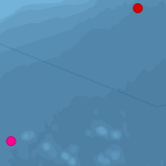
Probable track of the center of a tropical cyclone, displayed as points.
Updates
1-6 hours
Range
-7 days
Regions
Global
tropical-cyclones-invests
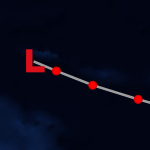
Displays active Tropical Invests (Tropical disturbances under investigation for further development).
Updates
1-6 hours
Range
-7 days
Regions
Global
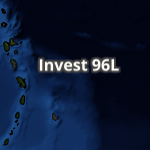
tropical-cyclones-invests-names
The names of the active tropical invests.
Updates
1-6 hours
Range
-7 days
Regions
Global
Modifiers
Font Size
lg
tropical-cyclones-invests-position-icons
The current position of tropical invests as an icon (L).
Updates
1-6 hours
Range
-7 days
Regions
Global
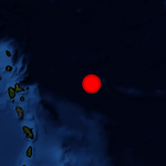
tropical-cyclones-invests-positions
The current position of tropical invests (as a dot).
Updates
1-6 hours
Range
-7 days
Regions
Global
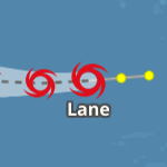
tropical-cyclones-names
Active tropical cyclones with up to a 5 day forecast, displayed with cyclone names.
Updates
1-6 hours
Range
-7 Days
Regions
Global
Modifiers
Font Size
lg
tropical-cyclones-position-icons
Current positions of active tropical cyclones depicted with an icon of storm intensity.
Updates
1-6 hours
Range
-7 days
Regions
Global
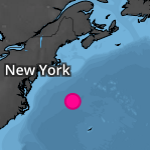
tropical-cyclones-positions
Current positions of active tropical cyclones.
Updates
1-6 hours
Range
-7 days
Regions
Global
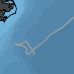
tropical-cyclones-track-lines
Tropical cyclone track lines for active storms only.
Updates
1-6 hours
Range
-7 days
Regions
Global
tropical-cyclones-track-point-icons
Active tropical cyclone tracks, displayed as icons.
Updates
1-6 hours
Range
-7 days
Regions
Global
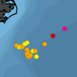
tropical-cyclones-track-points
Active tropical cyclone tracks, displayed as points.
Updates
1-6 hours
Range
-7 days
Regions
Global

visibility
Visibility as a distance.
Updates
15 minutes
Range
-7 days
Regions
Continental US
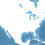
water-depth
Bathymetry water mask.
Updates
Range
Regions
Global
Modifiers
Map Theme
dk

water-flat
Water mask.
Updates
Range
Regions
Global
Modifiers
Map Theme
dk
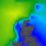
wave-heights
Global wave heights.
Updates
hourly
Range
-7 days
Regions
Global

wind-chill
Wind chill, where temperatures are at or below 40F (4.44C).
Updates
1hr
Range
-7 days
Regions
Global
Modifiers
Source
rtma
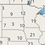
wind-chill-text
Numeric values of wind chill temperatures.
Updates
30 minutes
Range
-7 days
Regions
Global
Modifiers
Units
metric
Map Theme
dk
Font Size
lg
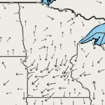
wind-dir
Surface wind direction depicted by arrows.
Updates
30 minutes
Range
-7 days
Regions
Global
Modifiers
Map Theme
dk
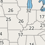
wind-gusts-text
Numeric values of surface wind gusts.
Updates
30 minutes
Range
-7 days
Regions
Global
Modifiers
Units
metric
Map Theme
dk
Font Size
lg
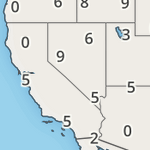
wind-speeds-text
Numeric values of surface wind speeds.
Updates
30 minutes
Range
-7 days
Regions
Global
Modifiers
Units
metric
Map Theme
dk
Font Size
lg