/lightning
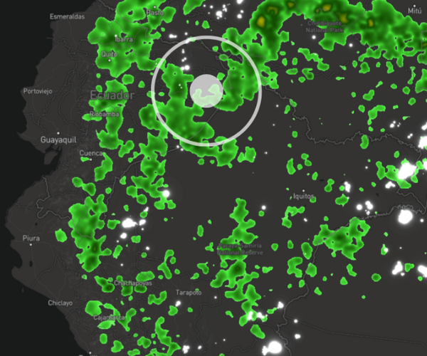
The lightning endpoint delivers near real-time, high-resolution global lightning strike data—including type, location, and intensity. Up to 1,000 events from the past 5 minutes within a 100 km radius.
The Xweather lightning data is built on real detection infrastructure, backed by a proprietary global network with decades of operational use across aviation, defense, and national weather services.
)
Xweather’s weather API delivers historical, real-time, and forecast strike data through dedicated endpoints, combining easy integration, advanced geospatial capabilities, and a proprietary global detection network backed by more than 40 years of operational history.
2 billion lightning events yearly
We detect the precise time and location of over 2 billion lightning events every year.
40 years of lightning detection
Backed by the longest-running lightning detection infrastructure in the world.
99.99% uptime
24 hours a day without the need to purchase or maintain additional equipment or systems.
84 m median accuracy
84 m median accuracy with precision network and 1 km globally.
The lightning endpoint delivers near real-time, high-resolution global lightning strike data—including type, location, and intensity. Up to 1,000 events from the past 5 minutes within a 100 km radius.
The lightning/flash endpoint provides real-time data on individual lightning flashes, with precise metadata for location, intensity, and strike type. Each flash includes timestamp, location, type (cloud-to-ground or intracloud), polarity, and peak amperage. Up to 24 hours and 50,000 events.
The lightning/threats endpoint identifies and tracks active lightning hazard zones, providing real-time polygons identifying threat zones classified as new, persistent, dissipating, or cleared, based on ongoing lightning activity and storm trajectory.
The lightning/analytics endpoint provides aggregated lightning statistics over time and space, enabling long-term analysis, risk assessment, and planning. Counts and densities of lightning activity over time, broken down by type, polarity, and intensity.
The lightning summary endpoint delivers a real-time, global snapshot of recent lightning activity for quick assessments and situational awareness of lightning pulses and strikes from the past 24 hours.
MapsGL leverages WebGL for smooth, data-encrypted weather animations. The visually impressive mapping layers are optimized for low-bandwidth use and are highly customizable.
Raster Maps is a tile-mapping tool ideal for still-image weather visualizations, offering 100+ layers compatible with basemap providers such as Mapbox, Google Maps, and Leaflet.
Explore real-time lightning strikes, wildfire boundaries, road weather data, and more, in Xweather's browser-based weather app. Xweather Live gives you a view of what's possible with our maps and API.
RESTful service providing precise global lightning data
Seamless integration into web, native, or mobile applications
Precise lightning strike location, polarity, peak current, classification, and timing
Low-latency delivery for operational alerting and automated decision-making
Example request
Response
Request data in the format that fits your stack. Control exactly which fields come back and in what order. Output formats include JSON, GeoJSON, CSV, and TSV.
Integrate lightning data into AI workflows through the Xweather MCP server. Query, analyze, and act on lightning intelligence within automated decision systems.
)
The most unique datasets in the market, backed by high-resolution, real-time data from a globally distributed proprietary infrastructure.
Access lightning endpoints in the Weather API and Maps subscription, with access to all endpoints, and to high-resolution lightning visuals via Raster Maps and MapsGL.
Xweather Lightning API covers real-time lightning strike detection, strike location and time, strike intensity, and historical lightning datasets for analysis and modeling.

:focal(983x1207:984x1208))