Reliable weather data for the road ahead
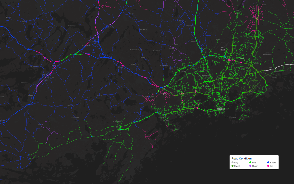
We help drivers and autonomous vehicles make better decisions for every journey. Our Road Weather API endpoints provide comprehensive road condition classifications (dry, wet, slush, snow, and ice), road surface temperature, and water, snow, and ice thickness. With robust documentation and SDKs, integrating road weather data and visuals into vehicles and applications has never been easier. Road weather data available through a Weather API subscription.

Water
Wet conditions account for nearly three-quarters of all weather-related road accidents. Even a small amount of water on the road reduces grip, and the risk of aquaplaning increases rapidly with heavy rainfall.
Identify dry and wet road conditions
Water film thickness

Snow
Snow is a common winter road hazard causing 17% of weather-related accidents in northern parts of Europe and North America. Unlike water, snow can be present on the road for long periods.
Identify snow and slush road conditions
Snow depth

Ice
Ice typically forms on roads when low temperatures turn morning dew into frost or freeze standing water on the pavement. Although ice is less common on roads than water and snow, it is far more dangerous for drivers.
Identify icy road conditions
Ice thickness
Road weather forecasts for the most demanding use cases
Infotainment and driver support
Road weather is the key to driver safety with timely hazard warnings and enhances other vehicle systems such as navigation and EV range calculation.
ADAS and AD
Road weather enables advanced driver assistance (ADAS) and autonomous driving (AD) systems to function reliably in a wide range of driving conditions.
Energy efficiency
Use current and forecasted weather data to optimize the thermal management of the battery, power train, and cabin to improve efficiency and extend the range of EVs.
EV range prediction
Enhance the driver experience with accurate, weather-aware EV range prediction that accounts for current and forecasted weather and road surface conditions.
Fleet management
Timely, relevant road weather data helps fleet operators keep drivers and vehicles safe and informed while maintaining operational efficiency.
Delivery and logistics
Take your route planning and timing to the next level with weather-aware navigation and protect drivers with predictive warnings of upcoming road weather hazards.

Water, snow, and ice depth in sub-millimeter level detail
Sophisticated sensor-based modeling
The Road Weather API is powered by advanced modeling through a proprietary network of road weather sensors, high-quality data sources, and algorithms that predict how environmental conditions and other factors will impact the pavement. Precipitation, solar radiation, traffic, maintenance activities, and the physical attributes of the road all play a significant role in the model.
Our Road Weather API combines these inputs with machine learning to produce an accurate nowcast for the road that updates every 15 minutes and a 24-hour forecast for longer trips.
Atmospheric weather
Solar radiation
Traffic
Winter maintenance
Artificial structures
Urban heat islands

Ground-truth validated data
Accurate, reliable road weather information makes journeys safer and more comfortable for drivers and passengers. We continuously improve our forecasts by validating our data against ground-truth measurements from road weather stations and mobile sensors.
Our solutions are the product of 85+ years of sensor development experience and more than 20 years of road weather forecasting. We work with top-tier vehicle manufacturers and automotive tech companies worldwide to improve driver safety, comfort, and convenience.

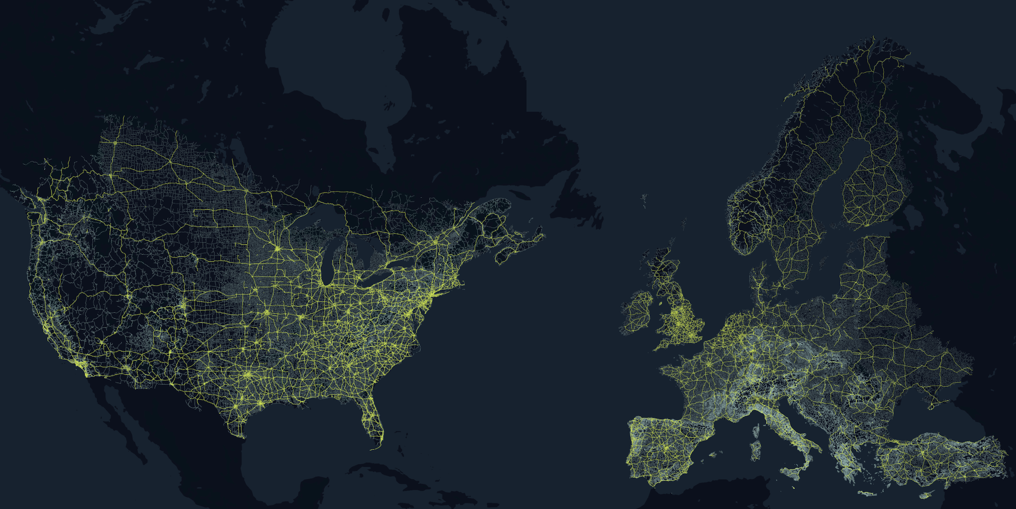
Millions of kilometers of roads covered
Vaisala Xweather's Road Weather data covers millions of kilometers of roads in North America, Europe, Japan, Australia, and New Zealand. We model primary and secondary roads separately to reflect the effects of different road surfaces, traffic levels, and maintenance priorities. Bridges are also modeled separately to account for the free flow of air beneath the road surface.
Unlike fleet-sourced data, which often has significant spatial and temporal gaps, our Road Weather data delivers real-time conditions and forecasts for every public paved road 24 hours a day, 365 days a year.

Weather API and Maps trials and pricing
The Weather API and Maps subscription provides road weather data and more through the Weather API — plus access to quick-built, high-resolution road weather visuals with Raster Maps and MapsGL and easily readable weather summaries from the Phrases API.
Get started with a free 30-day Developer Trial or purchase a Weather API and Maps subscription to integrate weather into your applications. Weather API and Maps subscriptions start at $300 monthly for 1 million accesses.