)
Satcom Global: Agile satellite connection for maritime operations
The first maritime weather dependency that comes to mind for most everyone is safety, but there are numerous other weather-affected factors. Today, we’re highlighting a lesser-known, safety-adjacent weather data use case: Satellite communications for maritime operations.
Satcom Global is a global leader in satellite services for the maritime, land, and aerospace markets. The company provides satellite data solutions for users in remote locations outside of standard terrestrial networks. Satcom Global is the go-to partner when you need to be connected but have no line-of-sight comms or radio signal - be it an off-the-grid research camp in Alaska, a global shipping giant, or a government agency.
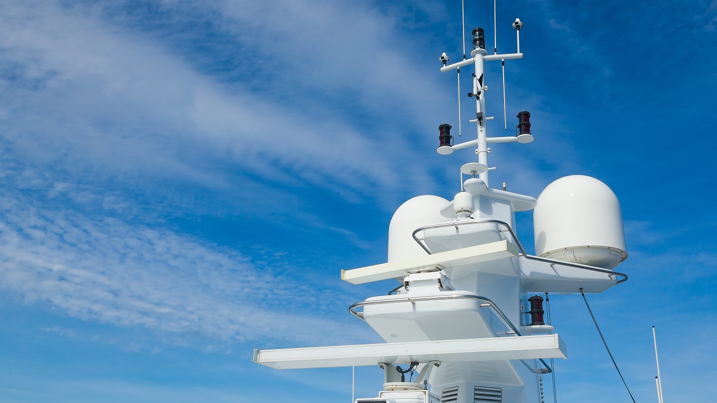
Satcom Global's star tool for maritime customers is AuraNow VSAT, a high-performance satellite solution that meets the ever-evolving needs of large shipping companies that are, in essence, at-sea network operation centers monitoring, controlling, and often managing remote operations.
AuraNow provides unprecedented flexibility, empowering vessel managers and owners to upgrade or downgrade their satellite bandwidth on demand through the AuraNow portal to avoid extra costs during low periods. Reliable satellite connectivity also plays an important role in maintaining almost normal day-to-day communications with those on land. In many instances, internet connection is a lifeline for those on the seas, providing a channel of communication with emergency services should the need arise and relieving mental strains that come from being isolated for long periods of time.
Challenge
To maintain connection, any ship-based satellite receiver must maintain a direct line of sight to the satellite in the Earth’s atmosphere. However, weather commonly affects satellite services, often introducing hurdles for maritime communications. Cloud coverage, storms, rain, and rough waves at sea can impact connectivity and cause outages.
Occasionally, the root cause of a service failure may not be immediately evident. In such instances, the ability to swiftly rule out weather conditions as the source of the issue can prove invaluable.
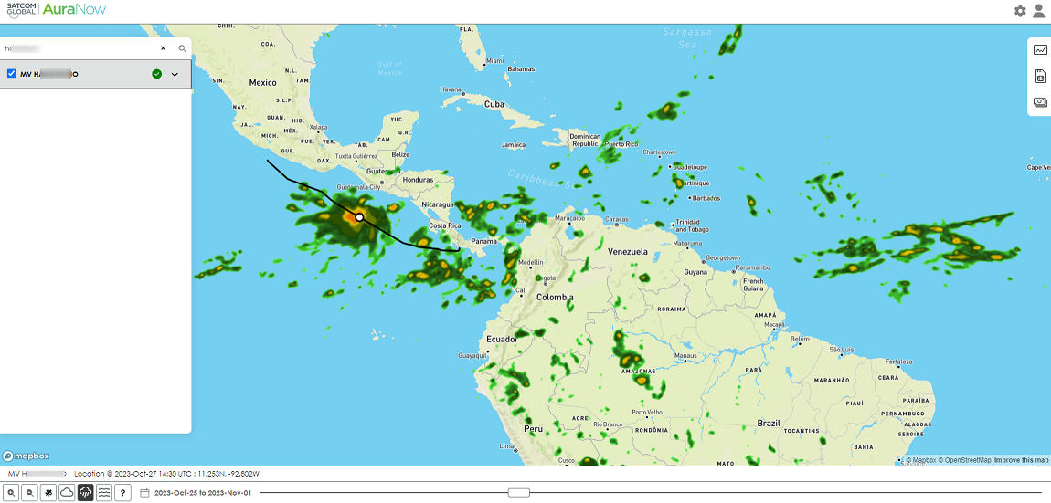
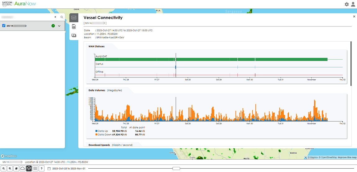
A screenshot of the AuraNow interface demonstrates how weather impacts a ship's path off the coast of Latin America.
The maritime environment holds a variety of potential sources of service interruption, ranging from on-ship satellite hardware glitches to interference from external factors. In such a complex ecosystem, isolating weather-related disruptions from other technical malfunctions becomes crucial and can save valuable time in the troubleshooting process.
Solution & results
Satcom Global has been deploying Xweather’s data and mapping as a feature within the AuraNow portal for almost 4 years now. Weather data integrated directly into the portal enhances awareness of potential outages and eliminates uncertainty about hardware malfunctions being the culprit. No more wondering whether the cloud coverage or rain might be behind the outage by calling the captain to check the weather outside – Crews now have real-time data to rely on.
Automatically identifying weather-triggered outages allows for timely alternative solutions, such as deploying L-band – or low-bandwidth - connectivity that can penetrate clouds, fog, rain, and storms. As part of the wider VSAT solution, L-band services are often present as a companion or backup solution, automatically switching between frequencies to ensure constant connectivity - for example, in emergency situations - to enable critical communications. The default connection, Ku-band, is high-speed and provides myriad features when the connection is stable. Since SLAs (service-level agreements) are more of a rule than an exception in the communications space, such automation is crucial in meeting service quality levels and maintaining customer satisfaction.
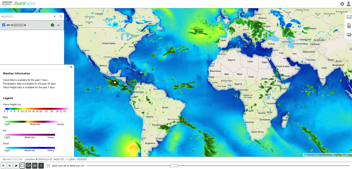
Weather data available directly within the portal also helps ships to steer around areas expected to generate unreliable connection – an added benefit to already-solid protocol.
Why Vaisala Xweather?
Aside from the developer-centric aspects of the Xweather API and mapping integrations, Satcom Global was especially drawn to how easily these integrations overlaid with their existing mapping and solutions. When combined with their own mapping iterations, Xweather’s mapping allows Satcom Global to view and track clients’ ships on the seas in real time and overlay these positions with historical shipping routes and weather. This allowed them to create an all-encompassing dashboard to view ships at risk of losing connectivity and to validate past outages at a glance.
After assessing several viable options, our developers loved this solution for its ease of integration.
Satcom Global’s AuraNow solution bridges the gap between life at sea and life back on the mainland. Beyond allowing crews to maintain some semblance of normalcy, the connectivity solution serves as a lifeline for when seas get rough, both ensuring the safety of crew members and optimizing maritime routes that may put the ship at risk of losing connection in areas experiencing detrimental weather.
Interested in adding weather to your own application? Reach out to our experts or get started with a free 30-day trial of our API and mapping.
)
)
)