Wondering how the weather is affecting road conditions along your journey? Look no further.
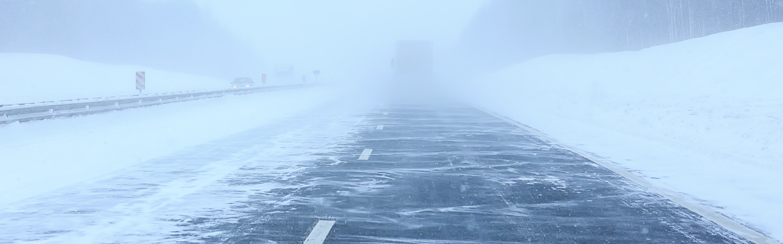
The onset of severe winter weather across northern latitudes keeps drivers vigilant, yet weather can still be unpredictable and surprising - especially on the road. In these scenarios, radio weather announcements warning drivers to take caution can only help so much.
Rather than being limited to radio updates, US truckers can now rely on Drivve, a handy road navigation app designed to enhance their safety and efficiency with real-time weather and road condition data.
What makes Drivve stand out among other apps aimed at drivers is that instead of simply telling a user that the temperature is 32°F, it provides information in the context of how the weather is affecting road conditions.
Enhancing the driving experience
“Road weather data is the missing part of the driving safety puzzle,” explains Spencer Vance, Drivve's CEO and Founder. “Our users are often driving in challenging climatic conditions, so getting the most reliable road weather information in an easy-to-use format is highly valuable to them.”
As any experienced driver knows, road safety is about more than simply understanding the current weather. It also demands knowledge of how weather affects pavement conditions on both primary and secondary roads.
The road weather insights in Drivve’s app are powered by Vaisala Xweather's proprietary road weather model. "Our road weather model allows for predictions on how weather impacts roadways, considering factors such as temperature, precipitation, traffic profiles, terrain, and structures like bridges. The model assesses safety risks and potential weather-related traffic disruptions," states Lasse Lumiaho, Product Manager of Road Weather at Xweather.
Our road weather model receives input from numerous high-quality data sources – including an extensive network of road weather sensors and in-vehicle data. With this data, the model "builds" primary and secondary roads separately to reflect the effects of different road surfaces, traffic levels, and maintenance priorities. In addition to informing whether the road is dry or icy, it also gives the latest data on surface temperature, friction estimates, and water, snow, or ice thickness.
Since weather plays a critical role in road safety, drivers benefit tremendously from having access to a predictive road and weather solution based on accurate real-time information. “Users can now make more informed decisions based on accurate and timely weather forecasts, leading to safer routes and better-prepared journeys,” says Vance.
Navigating with confidence
The fact that drivers have access to this level of real-time information has the potential to cultivate safer, more "strategic" driving behaviors. Until recently, drivers have relied on a combination of general weather forecasts, radio traffic reports, and in-car sensors to tell them about the conditions - but these all have limitations. Says Lumiaho of these gaps: "Traditional weather forecasts often don’t get down to the nitty-gritty of what is happening on the road surface; radio traffic reports tend to focus only on major hot spots and in-car sensors merely provide information on what is directly in front of you – not what you should anticipate further ahead. Additionally, drivers are well-accustomed to “false alarms” associated with the icy roads alert – that dreaded snowflake - coming on in their vehicle at times when the roads are completely dry, thus being conditioned to ignore them.”
Building this app with weather integrated from the start highlights the many weather-related challenges that drivers face. Not only does this make them more aware of the risks ahead, but it also influences how they plan routes to avoid potential hazards.
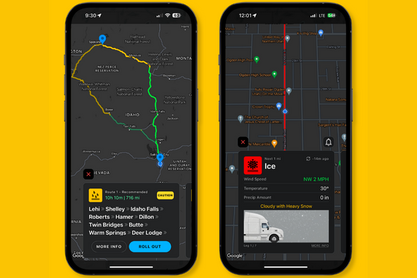
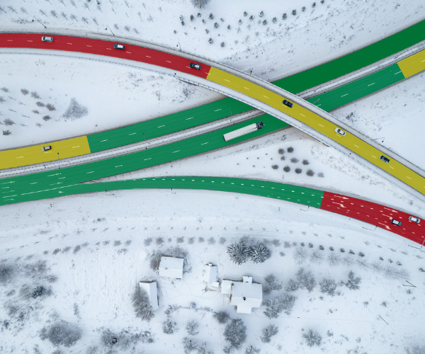
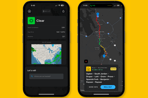
The app provides real-time weather updates along the route that is broken down into different-colored legs depending on the weather
"A typical user engages with Drivve by inputting their route details. The app then provides real-time weather updates along the chosen route that is broken down into different-colored legs depending on the weather, thus highlighting potential weather-related challenges and suggesting alternative paths for a safer journey," Vance explained.
Road weather data for all
Vance sees more opportunities to expand weather data usage: “We’re planning to expand and add new features, such as chain warnings and predictive storm updates as well as additional high-level weather data metrics, so our drivers can be confident on the road and know exactly what they are driving into.”
There are opportunities for accurate, app-based road weather data beyond the initial target market of truckers. “There’s a big appetite for this type of info among RV, motorhome, and caravan drivers,” explains Vance.
When it comes to road weather data, it has successfully found its role in powering applications beyond the consumerist audience. Says Lumiaho, "The data can be extremely useful for all road users as well as road maintenance professionals enabling proactive planning, safe and efficient routing, and timely maintenance decisions. Key use cases of road weather information include integration with connected cars and navigation, driver assistance systems, and maintenance decision support systems. The ultimate goal is to enhance road safety and efficiency by enabling timely responses and overall awareness to change weather and driving conditions."