
Smarter winter maintenance with full awareness of current and future weather conditions for your airport
Xweather Horizon uses advanced forecasting models and local sensor data from your airport to provide precise insights into current and upcoming conditions, empowering you to make well-informed decisions for every weather event.
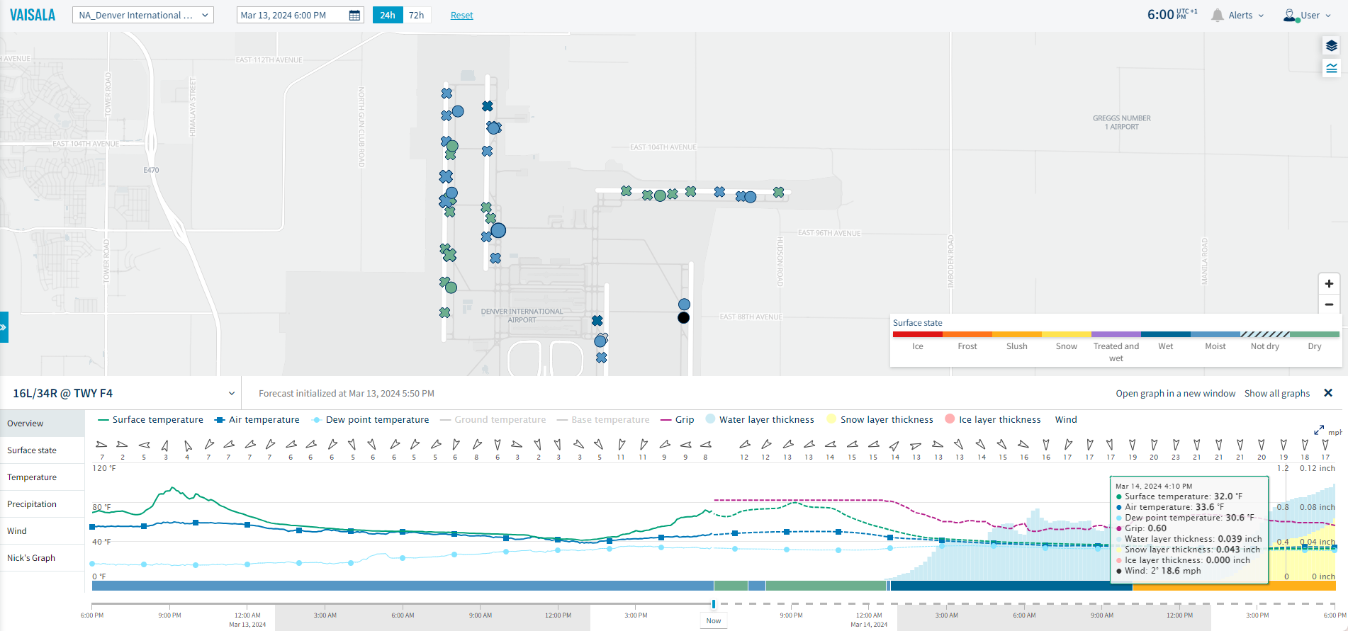
Take action exactly when and where needed
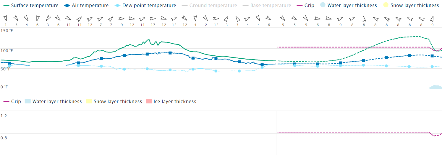
Have maximum situational awareness
Gain full awareness of current conditions across your airport through Vaisala reference grade Weather stations and Xcast sensors that measure a variety of parameters including runway surface temperature, air temperature, dew point, and relative humidity.

Target your treatments with confidence
Ensure you treat exactly when needed by using forecasts driven by local data. The forecasts are generated specifically for your airport runway and taxiways, capturing the nuances that more generic forecasts miss. No wasted chemicals while also ensuring safety at all times.
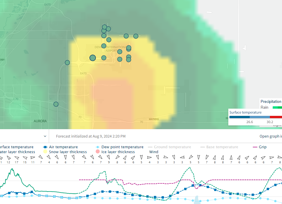
Never miss any changes in the weather
If weather conditions change or airport conditions are becoming hazardous, you will be notified immediately and can take the appropriate action.
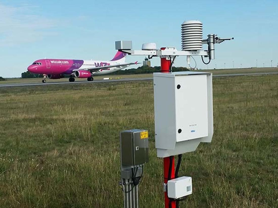
Enhance your forecasts with sensors and stations
Your Xweather Horizon subscription unlocks observation-enhanced forecasts for all your sensor locations.
Runway weather stations
Vaisala RWS200 is a reference-grade weather station that has been validated in the harshest winter weather conditions. It’s highly configurable, easy to use, and supports intelligent system integrations and operability.
Learn more about RWS200
Xcast sensors
Vaisala Xcast sensors are wireless, battery-powered, and maintenance-free. With proven performance and quality you can count on, these IoT sensors integrate seamlessly with Xweather Horizon.
Discover Xcast Sensors
Mobile sensors
The Vaisala Mobile Detector MD30 is the first device designed specifically for snow plows to accurately collect and transmit data on road and runway surface state, grip, and surface temperature along the route.
Learn more about MD30

Features for efficient winter maintenance
Insights dashboard
Xweather Horizon transforms complex weather data into clear visual insights. Quickly identify critical scenarios at your airport without constant monitoring.
72-hour runway weather forecast
Pinpoint when and where the weather will affect your airport up to 72 hours ahead. Target treatments precisely while avoiding unnecessary applications.
Status layers for critical parameters
Monitor surface condition, temperature, grip, and air temperature with dedicated data layers covering your runways, taxiways, and apron.
Alert notifications
Set thresholds for sensor and forecast parameters and instantly notify your team when ice forms, temperatures drop, or grip deteriorates beyond safe limits.
10-day atmospheric weather forecast
Plan ahead with 10-day forecasts for temperature, precipitation, and wind. Access radar, satellite, and "feels like" data for additional insights.
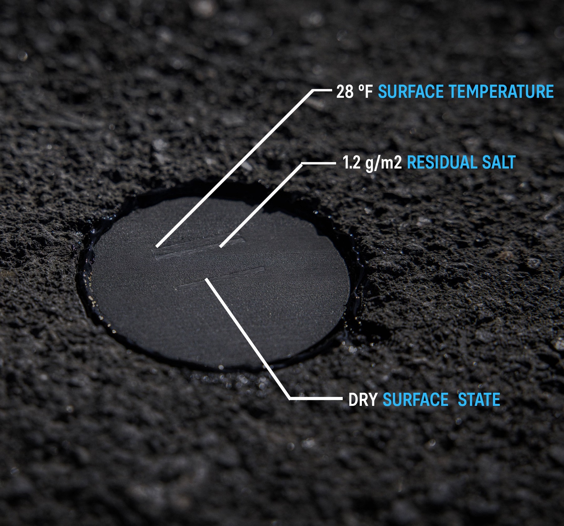

Unmatched forecasting accuracy with Xcast
Imagine receiving observations and forecasts for key areas across your airport—easily and affordably. Look no further. Xcast is a synthesis of high-precision measurements from the sensors and weather station across your airport and sophisticated forecasting models.
The sensors provide high-quality observations and up to 72-hour forecasts across your airport. Now, you can make data-driven winter maintenance decisions with true confidence and maximum situational awareness.
Full situational awareness at all times
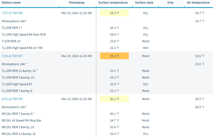
Table view
See all your sensors and measurements in a table.
Easily access historical data and forecasts.
Download all data as a CSV file.
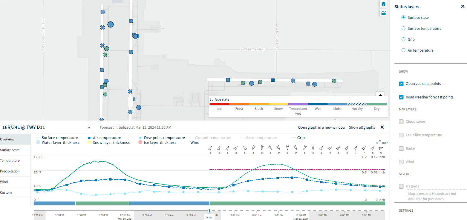
Map view
Map view shows the most important data you need to make the best decision. Change layers from surface state to surface temperature or grip and make yourself aware of the latest conditions.
Security built in
ISO 27001
Xweather maintains continuous risk management processes and rigorous information security protocols, ensuring that all data in Xweather Horizon is handled securely.
SOC2
Xweather aligns with SOC 2, which requires us to manage and protect the security, confidentiality, privacy, integrity, and availability of customer data.
Cyber Essentials (UK)
This certification ensures that Xweather maintains effective defenses against the most common cyber threats and vulnerabilities.